-
Tucumcari, NM to Albuquerque, NM
The night was still a bit young and after writing last night’s blog we stopped by the campfire where we met up with Tom, one of the owners of the campsite, and a couple from England and had our first moonshine from Georgia. We talked about local politics, car racing and rich people in Bermuda who have to cut their cars in half in order to be allowed to buy a new one. There was some discussion of the benefits of having a BMW or Mercedes on an island that has a speed limit of 20 miles per hour.
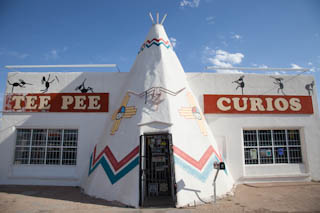
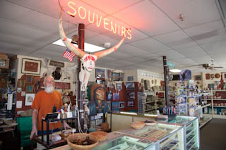
The next morning we visited Tee Pee Curios and bought some interesting Mexican items.
The owner, Mike Callens, is an accomplished photographer and sells some of his prints in the store.
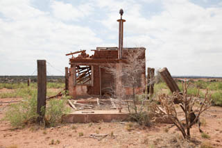
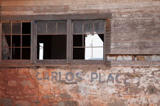
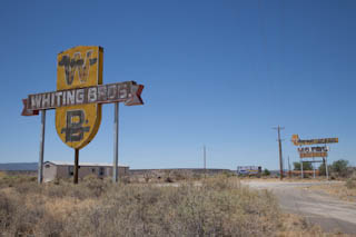
We drove on, mostly on I-40 since Route 66 is fragmented or dirt road in many parts of New Mexico. Just outside of Newkirk we came across remains of an old gas station and restaurant.
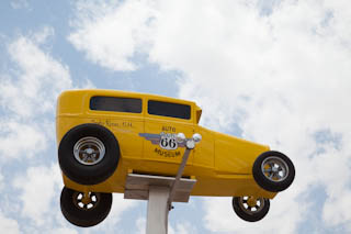
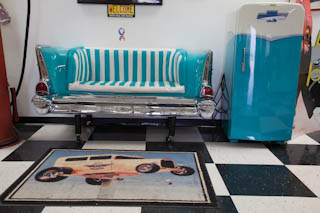
In Santa Rosa we visited the Route 66 Auto Museum.
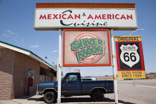
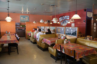
Lunch was at a Mexican and American cuisine restaurant called the Silver Moon which was established in 1959. The food was great and the souvenir shop wasn’t bad either.
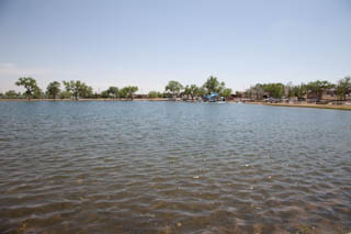
Santa Rosa is a very special city in that it has a collection of artesian springs in the area. The most famous is the Blue Hole which is more than 80 ft deep and 60 ft wide.
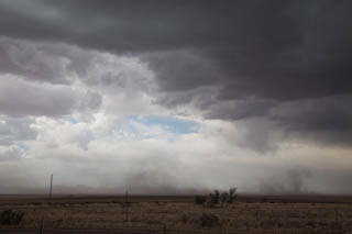
Back on our route, we were very happy we had decided not to go to Santa Fe when we saw the smoke from the forest fires. In the picture below, the you can see the smoke cloud caused by the fire.
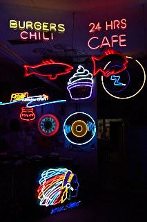
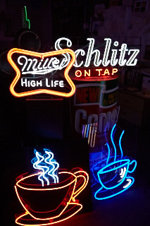
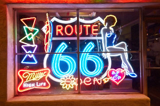
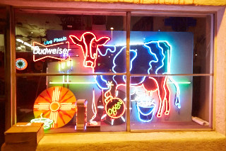
We made it to Albuquerque and stopped at Absolutely Neon, only because it was one of the waypoints that we had on Route 66.
This was a good thing because we met Robert Randazzo, the owner of the store/gallery.
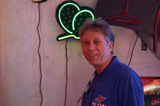
After talking for four hours about neon signs, politics and everything else under the sun, we decided to buy a small neon sign and then the three of us headed out for dinner at around 9PM. The Vietnamese restaurants we had intended to go to were closed by now so we ended up in an Italian restaurant in a very trendy area.
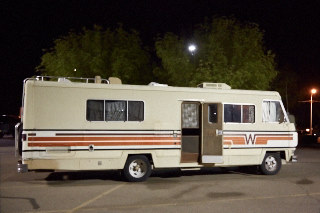
After pizza and beer we headed off to a nearby Walmart parking lot for a good night sleep. Those of you who watch Breaking Bad on TV (which is filmed in Albuquerque) might recognize our RV neighbour.
-
Albuquerque, NM to Elephant Butte, NM
After spending the night on the Walmart parking lot, it was only fitting that we visit the store for breakfast at the McDonald’s inside.
Our packed day started with a 2-3 hour visit of the National Museum of Nuclear Science and History where we learned all about the Manhattan Project (first nuclear bomb) and nuclear materials in warfare, medicine and power generation.
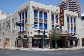
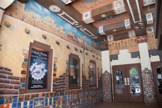
Next was a visit to an older section of Albuquerque where we saw the KiMo Theatre, built circa 1927 in the Pueblo Deco style which reflects the cultural influences of Indian, Hispanic and Anglo of the area.
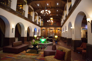
Also in the area is the Hotel Andaluz, a former Hilton property from 1939 where Conrad Hilton married Zsa Zsa Gabor in 1942.
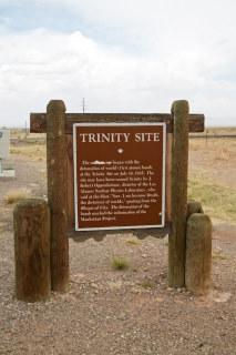
We decided to do an excursion to White Sands National Monument in the south. On the way we passed the White Sands Missile Range where we found a plaque near the Trinity Site where the first atomic bomb was tested. The actual site can be visited only twice a year.
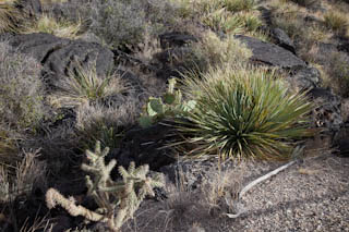
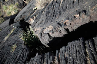
Next came the Valley of Fires National Recreation Area which had nothing to do with the atomic bomb, but is an area of lava flow about 5000 years old. Many plants and animals live in this area now and a short interpretive trail helps visitors identify them.
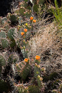
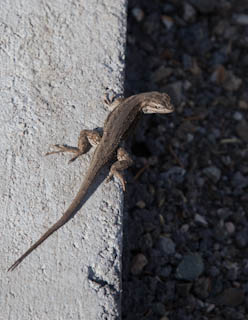
Among the animals listed were lizards and Martin was complaining he didn’t see any of them. Evidently the lizards heard this and shortly thereafter two appeared.
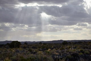
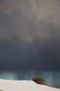
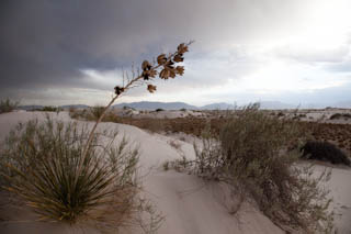
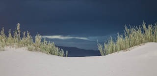
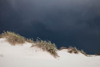
Another thunderstorm loomed as we arrived at the White Sands National Monument where we arrived shortly before sunset. We only had 30 minutes or so before the sky turned completely back and the lightning flashes were close.
The weather report called for a severe thunderstorm with hail up to 1 inch. Not wanting to risk damaging the van, we decided to head back towards Albuquerque, about 4 hours away. Along the way were were stopped by the Border Control folks searching for illegal immigrants. They didn’t have any problems with Canadian tourists.
About 240 km from Albuquerque we stopped at the Cedar Cove RV & Mobile Home Park in Elephant Butte. What a fabulous place. The showers are huge, wheelchair accessible and absolutely spotless.
-
Elephant Butte, NM
Today we managed to cover a whole 26 kms but had a lot of fun.
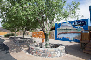
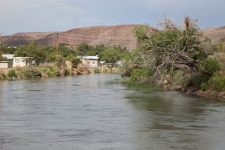
After picking Cindy’s brain at the Cedar Cove RV park for things to do in the area we started with a brunch buffet at the Hodges Corner Restaurant. Kim, one of the waitresses there, recommended the Riverbend Hot Mineral Springs Resort and Spa right at the Rio Grande. They offer a Soak and Float package which includes an hour of soaking in their five hot spring tubs and an hour long float on an inner tube 6 miles down the Rio Grande. Wow, what a lot of fun!
Back to Hodges Corner Restaurant for dinner and the Cedar Cover RV park for the night where we expect to have an extremely relaxing sleep.
-
Elephant Butte, NM to Albuquerque, NM
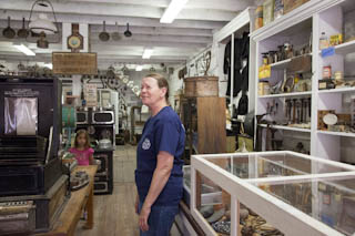
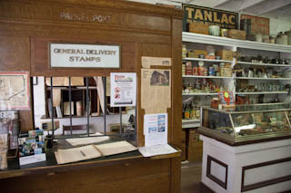
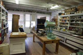
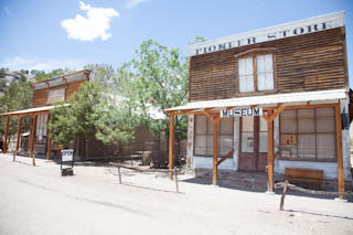
After a good night sleep due to our hot springs relaxation day we had a long talk with a gentleman from Britain who helped us to delay our departure from New Mexico yet again. He suggested we visit Chloride, a former Ghost Town turned open air museum through the initiative of Dana and Don who fell in love with this old silver mining town when they first saw it on a vacation trip. They began buying up the buildings and began the renovations of each and every one without the financial help of the government or any other organization. The greatest find was the old general store which was locked up and closed for ca. 50 years with all the merchandise, equipment, furniture, safe and ledgers still in it. Going into this store is like entering a time capsule.
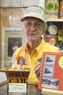
From there we visited the small town of Winston which was buzzing with cowboys and cowgirls because it was fiesta time with country and western music, pulled beef and beans, belt buckles, Stetsons, cowboy boots and the occasional horse.
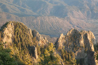
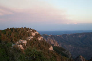
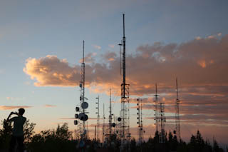
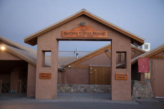
Now it was time to finally return to Albuquerque. We returned to Robert’s Neon Shop and started a great evening program. First we drove up to the Sandia Peak, 10,678 feet high and enjoyed the spectacular view and the cool breeze, a nice change after a long day in the heat of up to 38 degrees celsius.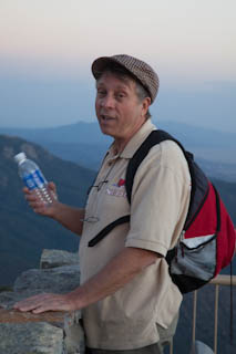
Afterwards there was no time for beautification, we set out to go to Ned’s Bar and Grill to see and hear Robert’s friend Raven and her band singing the Blues (and a bit if Jimi Hendrix, thank you Robert!). After some Mexican Food and Jack Daniels we made it out of this place at 1:30am! Time to sleep at Walmart again.
-
Albuquerque, NM to Grants, NM
We were still unable, despite all our good intentions, to leave New Mexico! The motto of the State really seems to haunt us: Land of Enchantment, although some of the locals call it Land of Entrapment. But we are still enchanted and don’t feel the danger of being trapped yet, the RV was still moving west.
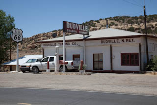
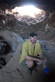
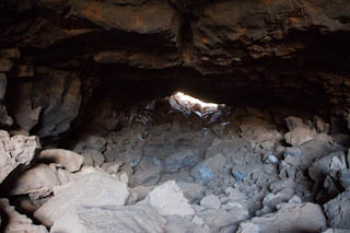
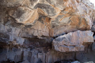
Driving through beautiful red rock formations, visiting a couple more abandoned gas stations and motels i.e. in Budville we made it to El Malpais National Monument where we crawled through a lava tube, not easy with two cameras and a scared dog that needed to be lifted down off some of the larger rocks by Martin.
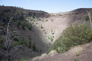
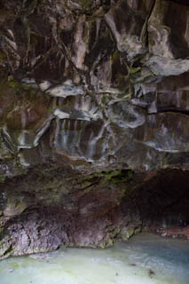
After this sweat inducing endeavour we first climbed up the Bandera Volcano and looked into the immense crater and then had a chance to cool down at a nearby ice cave which has 20 feet thick ice all year round. Gusty wither winds and snow replenish the water which forms into ice and remains this way because of the rule, warm air rises, cold air falls. Summer heat never enters the cave. Ice cream time was to follow, which we really deserved since we were dusty, sweaty, tired and hungry.
The only flop of this great day, driving through forests in the 7.000 feet range in brilliant weather with great sights was the fact that we arrived at 5:15 pm at El Morro National Monument for 1/2 a mile hike to the petroglyphs depicting 700 years of human activity when the trail closed at 5 pm. We were so disappointed that we even refused to watch the movie. We retraced our steps back to Grants and stayed at a lovely KOA RV site with free breakfast and optional home cooked dinner delivered to the camp site at a reasonable price, what a treat!!! Turkey Dinner with all the fixings, HMMM!
-
Grants, NM to Navajo, AZ
Hurray, we made it to Arizona! —-well, not until the evening and just past the State Border (ca. 20-30 miles in)
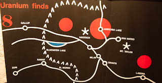
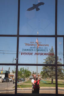
But first we visited the New Mexico Mining Museum in Grants. They even had a reconstructed Uranium Mine and a very knowledgable retired mining expert as guide.
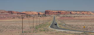
Now we really booted it towards Arizona, or that’s what we thought. We stopped 10 minutes later for some pictures of breathtaking scenery which Martin captured in one of his panoramas.
The we reached the Continental Divide and no, we didn’t pour water on both sides to see that it runs to the Atlantic on the Eastern side and to the Pacific on the Western side.
But we started our shopping spree of Navajo arts and we couldn’t stop the shopping accidents for quite some time. Even during our lunch break at Earl’s Family Restaurant at Gallup, where local craftspeople offered their art right at the table. A lot of deciding was done and some pretty items purchased, but the delicious burritos were still enjoyed very much.
Gallup is an interesting town with theatre, city hall, etc. but most prominent are the many, many stores of native art and western accessories. And yes, we had to purchase some of these … a cowboy hat for Martin and boots for both of us.
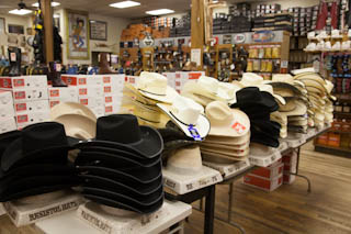
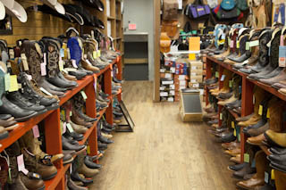
After a quick stop at Walmart, our favourite “watering hole” we finally left the state and entered Arizona at a time when the Visiter Centre was closed already. Now we are sitting at a gas station/truck stop with the big boys but we don’t dare to wear our cowboy boots yet!
-
Navajo, AZ to Meteor Crater, AZ
Despite truck fumes – some of the big guys let their trucks run all night- we had a good or maybe even better sleep. Breakfast was on a bench at a little park at the truck stop and a very peculiar man dropped by with not too clean clothes but one gold tooth and very white teeth. He had a lot of questions and some insightful comments, but we still did not exchange e-mail addresses.
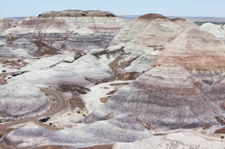
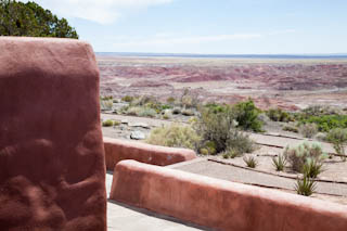
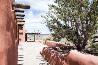
Instead we took off for Petrified Forest National Park, now no longer accessible via Route 66 but in the 50s and 60s on the route. Our quick excursion took half a day! Painted Dessert, beautiful rock formations, petrified wood and the Painted Desert Inn at Kachina Point were of great interest.
The Inn was built in the 1920s and restored by the Civilian Conservation Corps (a make work program for young unemployed people) in the 30′. Later it became a Harvey House http://harvey-house.info/arizona, http://en.wikipedia.org/wiki/Fred_Harvey_Company. The architect for the reconstruction in the 30’s was a woman, Mary Elizabeth Jane Colter. We will meet her again in Winslow, AZ where she designed the beautiful La Posada Hotel. Her aim was to integrate her buildings into the landscape through shape and colour. Fred Kabotie, a very well known Hopi artist painted the storytelling murals.
Not quite as fancy as the Inn but nevertheless attractive was the Wigwam Motel in Holbrook and the old cars in front of each of them made it look even more authentic Route66.
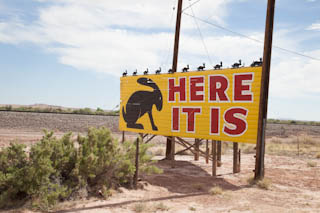
The Jackrabbit Trading Post, no longer an attraction any more, was not that fascinating but Winslow definitely made up for it.
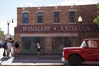
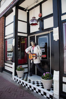
A railway town with connections to “The Eagles” and their song “Take it Easy” because one line in this song places them right into Winslow “Well, I’m standing on a corner in Winslow Arizona and such a fine sight to see”. We visited the corner, saw a statue in honour of the Eagles, listened to the song a dozen times because it was played over and over again at all stores.
We met three very dedicated people: Patrick the cyclist, Morgan the support cyclist and Mike the driver and organizer of this little outfit with a big heart. These three people are raising money for cancer research and help make a wish come true for some people with cancer, for example, a bicycle for a little girl in hospital.
Dinner was at a former trading post turned restaurant run by a young man and his former school teacher mother. Mexican food it was and it was delicious.
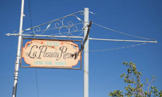
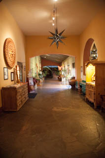
With renewed energy all three of us marched to the famous La Posada Hotel, another Harvey Hotel designed by Mary Elizabeth Jane Colter. Absolutely great, a bit of nature, a bit of Monastery and museum where dogs are allowed in. The prices for rooms are not even that bad and we wouldn’t mind spending some time there at our next visit.
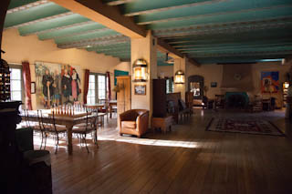
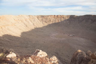
Last but not least we visited the Meteor Crater. Quite impressive and the museum gives it a vast context, which makes this even more complex.
We limped very tired to the Meteor Crater RV Park.
-
Meteor Crater, AZ to Williams, AZ
Thank God for free coffee at the RV Park! We left in good time and at first it really looked like we would make great progress, California seemed so close but…
Flagstaff went still without mayor delays. We had a nice brunch at The Crown Railroad Café since the neighbouring vintage roadhouse Museum Club was still closed. The railway motif at our restaurant was not bad though and the omelettes delicious.
Off we went to Williams. Wow, what a place, gateway to the Grand Canyon, a hub for the railroad and Route 66 in full swing!
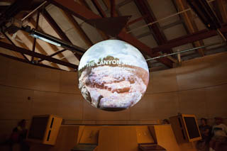
From there we should have gone West, but 60 miles to the Grand Canyon seemed like a short distance. OK, we spent the rest of the day at the Grand Canyon, watched a presentation and a movie at the visitor centre and took the 25 mile route along the south rim.
We’re very happy that this excursion cost us another day! We had dinner at a Steak House and went back to Williams to stay at the privately owned Canyon Motel & RV Park with yet another railroad theme. You can even get a room at a train car.
-
Williams, AZ to Fenner, CA
We left the RV park, drove one more time through Williams without stopping and went right on to Seligman with only one short halt to photograph a neat hair salon.
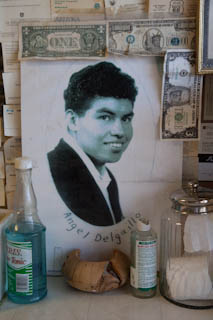
Seligman is as much alive as Williams but without the Grand Canyon action. It’s claim of fame is the fact that it is situated on one end of a 150km stretch of old Route 66 Mother Road from Seligman to Topock. Furthermore it is home to yet another Harvey House -now the Black Cat Bar- and to two iconic brothers, Angel and Juan Delgadillo.
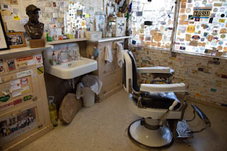
Angel had a barber shop and is well respected for all his efforts to keep Route 66 alive.
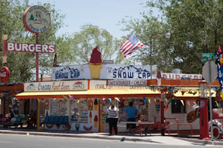
Juan, who died a couple of years ago owned the Snow Cap Drive-In, which is still open, now run by his son who has a great talent to make people laugh, just ask for some mustard and you think you will be wearing it … and it was only some string popping out of the mustard bottle.
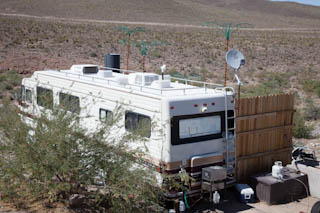
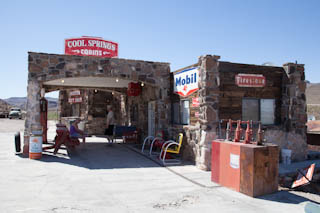
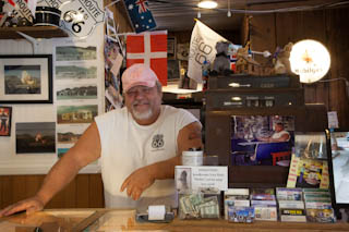
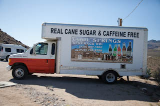
Well fed and happy with our little purchases we went on, passing through some remnants of villages, laughing foolishly about signs declaring these dusty valleys as flood zones and began climbing into mountain areas. At Cool Springs Camp, a neat store next to a camper with fake palm trees on its roof, we met George who is the distributer for Arizona of our favourite Route 66 Soda. Besides this job he is the man behind the counter of the Cool Springs Store with the pink cap.
The building was rebuilt for a movie set at one point and is now a great place for a chat, some ice cream but -at least when we were there- not for Route 66 Soda.
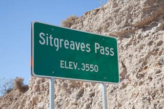
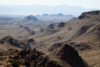
Off we went to climb the steep and narrow road through beautiful mountains to Sitgreaves Pass. What a beautiful view.
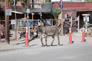
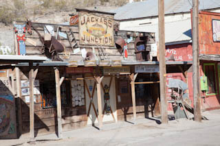
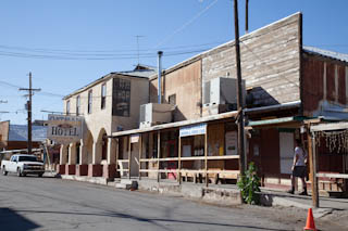
We then saw our first real former Gold Rush town, Oatman, or so we thought. There were buildings like in a Western movie, some for sale, the others open for tourists. Donkeys were walking through the street. The reason for this was, that once the Gold Rush was over, the working donkeys were let go and they took to the desert to live but come to town to be fed. The people who stayed after the gold mine closed tried their luck with catering to tourists. But at 6pm the bustling town became quiet. Donkeys and people left the place to go home and now it really was a movie set after the lights went out.
The gold mine is back in business though. We saw the operation and the warning signs that tresspassing was strictly forbidden when we came down the mountain on the other side.
We couldn’t believe it, we did make it to California, the land of milk and honey after all. But we really can feel for the Okies (refugees from Oklahoma, seeking work in California after the Dust Storms in the 19th century) who found yet another desert, the Mojave desert, after crossing the Colorado River. Their track through heat and desert would continue for a long time.
Needles, the first city we reached, is one of the hottest cities in the United States with temperatures exceeding 100 degrees Fahrenheit frequently. When we drove through in the afternoon it was 42 degrees Celsius. Gas, which had been in the $3.59 to $3.89 range throughout our trip, was $4.99 in Needles.
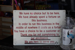
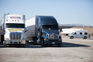
We had enough for today. With no RV park in sight we stayed at the gas station of Fenner -the only thing left of this town- and even this gas station, close to the Interstate 40 but still on Route 66 is fighting for its life, as their signs made very clear to their customers. Gas was over $5.00 here.
-
Fenner, CA to San Bernardino, CA
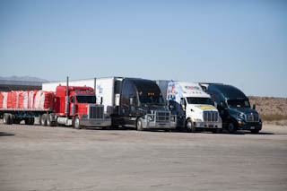
Could it be that last night was the last night we spent with the big boys at a gas station? Just in case I ventured out this morning to take a couple of pictures of the scenery.
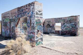
We then we hit the road for a full day of desert sites in California. In Cadiz area we photographed graffiti on the remaining walls of a former tourist complex.
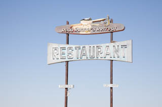
In Chambless the beautiful huge sign of a former restaurant called The Roadrunner.
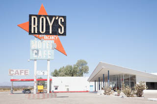
In Amboy we visited Roy’s store and gas station and took a look at the small cottages under reconstruction. A man in the chicken business had bought the entire town and is trying now to revive the business.
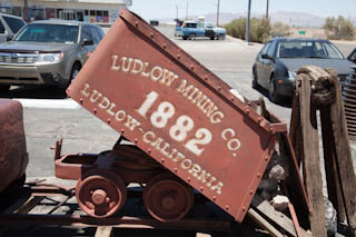
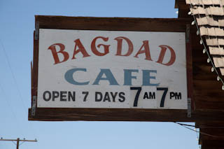
We missed Bagdad, if it still exists, which gave the name for the German movie from the 80’s “Bagdad Café” or “Out of Rosenheim” but we did see the location where it was filmed after our lunch break. We had lunch in Ludlow at the Café with the former mining company town’s name.
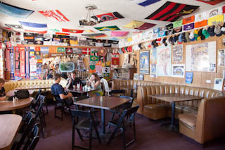
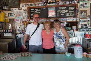
Newberry Springs is the place where the movie “Bagdad Café” was filmed. The restaurant was the former “Sidewinder” but changed its name because of the movie to “Bagdad Café” in the 90s. We had a chance to talk to the very nice owner of the café, Andrea Pruett, who had bought the place together with her husband in the 90s. She is a screenplay writer herself but has little time to pursue this line of work because of her ostrich ranch and the café.
We continued through Barstow where we visited an antique market and stood in front of the already closed Route 66 museum. But we were tired anyway and proceeded to an RV park right in the city of San Bernardino. Since this part of the city is not one of the safest we decided to stay at the gated park, have a home cooked dinner in our RV and go for a walk. Tomorrow the trip from San Bernardino to Santa Monica will be our last day on Route 66. We are not sure whether this will be cause for celebration or whether it will be a sad farewell to a dear friend of 3 weeks.
2013 Route 66
- Places
- Canada
- USA
- Alabama
- Alaska
- Arizona
- California
- Colorado
- Florida
- Georgia
- Idaho
- Illinois
- Indiana
- Iowa
- Kansas
- Louisiana
- Michigan
- Minnesota
- Mississippi
- Missouri
- Montana
- Nebraska
- Nevada
- New Mexico
- New York
- North Carolina
- North Dakota
- Ohio
- Oklahoma
- Oregon
- Pennsylvania
- Route 66
- South Carolina
- Texas
- Utah
- Virginia
- Washington
- Wisconsin
- Wyoming
- Trips
